A Tour Of The Civil War Sites
On
Roanoke Island, North Carolina
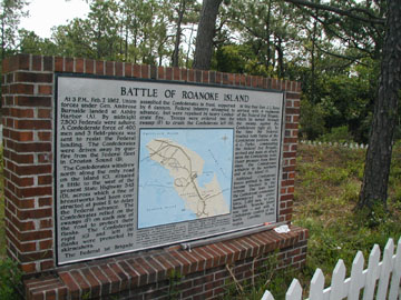
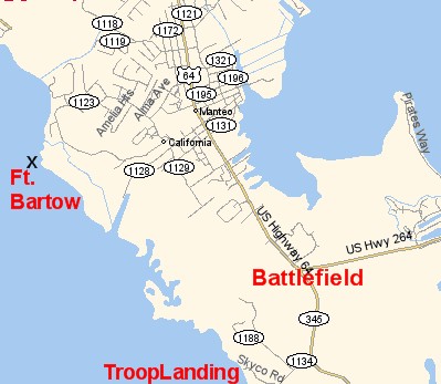
At the Midway intersection On Roanoke Island (the junction of route's 64, 345 and the road to the Virginia Dare bridge) drive south towards Wanchese. Just past the intersection on the left is an historical marker with information about the battle. A small section of earthwork is all that remains of the Suple's Hill Earthwork. You are now on the battlefield.
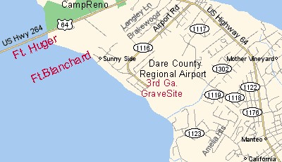
Drive south past the water tower 7 tenths of a mile and look for Skyco Road on your right. Turn right and proceed to the end of the road which terminates at Croatan Sound. This is Ashby's Harbor where Burnsides Division executed an amphibious landing on February 7th, 1862. Skyco road is essentially the same road that Union troops marched up towards the earthwork. Travel back up the road and turn left back onto U.S.64 Drive through the town limits of Manteo and north towards the upper end of Roanoke Island. Turn left onto airport road and proceed towards Dare County Regional Airport. Once in the parking lot note the small white picket fenced in area inside the airport grounds just to the right. The small cemetery is where Thomas Fitzpatrick of the 3rd Georgia is buried. Drive around to the public access area along the shore of Croatan Sound. Look to the south. Fort Bartow was located just North of the spit of land that juts out from the shore line. Considerable activity occurred in the area you are in during the war. Camp Georgia and the Freedman's Colony was located near by. Get back onto U.S.64 and head north. Just past Ft. Raleigh National Historical Site slow down and turn right onto Heritage Point Road. Go down about halfway down the road and pull off onto the shoulder of the road. You are now right in the middle of Camp Reno.
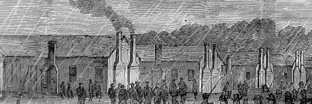
Imagine what the camp would have looked like in 1862. You would have seen over a dozen large wood sided barracks buildings with smoke wafting gently out of their numerous brick chimneys. And soldiers, some milling about the barracks, others returning or leaving for guard mount over the camp or duty in one of the forts.
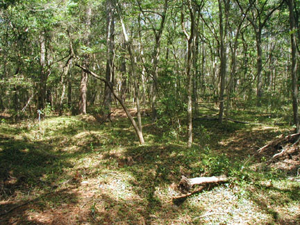
The "kitchen" in Camp Reno. I was told an entire cast iron cook stove was excavated out of this area back in the early seventies, thus earning it's nickname. This is where I first sifted for artifacts.
Drive back up to the main highway and turn right. Slow down just before it appears your going to drive onto the Umstead bridge. Turn left into the small parking area and park your car. You will see to historical markers identifying Forts Huger and Blanchard.
The tour ends here.